
نرم افزار OMNI 3D Workshop 2021 طراحی نقشه برداری لرزه ای
- ◷ 1401/01/21
- دیدگاهها برای نرم افزار OMNI 3D Workshop 2021 طراحی نقشه برداری لرزه ای بسته هستند
نرم افزار OMNI 3D Workshopنرم افزار ی قدرتمند جهت طراحی نقشه برداری لرزهای سه بعدی است که به شما کمک میکند تا طرحهای دو بعدی و سه بعدی بهینه را برای زمینها، دریاها، کابلهای پایین اقیانوس (ocean-bottom cable; OBC)، منطقه انتقال، مشخصات لرزهای عمودی (VSP) و بررسیهای چند جزیی ایجاد کنید. ماژولهای آنالیز پیشرفته درنرم افزار شما را قادر میسازد تا اثرات هندسه را بررسی کنید، مصنوعات هندسی را تجزیه و تحلیل کنید، مواد مصنوعی تولید کنید و مدلهای زمینشناسی دوبعدی و سه بعدی را بسازید و ردیابی کنید.
نرم افزار OMNI 3D با ابزارهای پیچیدهای که در اختیار شما قرار میدهد مانند رابط کاربری آسان و مدیریت چند پروژهای همه کاره، به پر کردن شکاف بین داراییهای E&P و تیمهای استخراج کمک میکند. این ویژگیها نرم افزار OMNI 3D را به استاندارد صنعتی برای دانشمندان زمین شناس تبدیل کرده است. نرم افزار OMNI در برنامه ریزی، طراحی، کنترل کیفیت و مدل سازی بسیار قدرتمند است.
OMNI 3D Seismic Survey Design
در نرم افزار OMNI ماژولهای تجزیه و تحلیل پیشرفتهای قرار دارد، از جمله ارزیابیهای هندسه سهبعدی، ترکیبی، تخمینهای کیفیت ردیابی با استفاده از تفسیر 5 بعدی، پاسخ AVO، روشنایی در افق زیرسطحی با استفاده از هر هندسه بررسی، و روشنسازی مهاجرت زمان پس از پشته با استفاده از binning منطقه فرنل را ارائه میدهد. نرم افزرا OMNI امکان ایجاد مدلهای زمینشناسی سهبعدی و بررسی پارامترها، پراشهای مدل، بازتابها و مسیرهای پرتو را برای شما فراهم میکند.

نرمافزار طراحی نقشه برداری لرزهای OMNI 3D در واقع یک استاندارد صنعتی برای طراحان این حوزه، مدلسازی و تحلیل اکتساب پیمایش لرزهای است.نرم افزار OMNI 3D طرحهای کاملاً بهینهسازی شده را برای زمینها، دریایی، مناطق انتقالی، مشخصات لرزهای عمودی (VSP) و بررسیهای چند جزئی ارائه میدهد. قدرت ماژولهای تجزیه و تحلیل پیشرفته آن را برای بررسی مسائل هندسه بالقوه، وضوح یا اثرات مهاجرت آزاد کنید. ابزارهای پیچیده، رابط کاربری آسان و مدیریت چند پروژهای همه کاره، نرم افزار OMNI 3D را به گزینهای برای دانشمندان زمین شناسی درگیر در برنامه ریزی، طراحی، QC و مدل سازی در سراسر جهان تبدیل کرده است.
قابلیت های OMNI 3D Workshop
User-orientated design
Get enhanced usability with easy-to-learn functionality and icon-drive interface
Data loading and data export
Import field data from industry standard formats (SPS, INOVA® Hawk, SEG-P1, P1/90, and P1/11)
Export designs for the field in industry standard formats
QC Tools
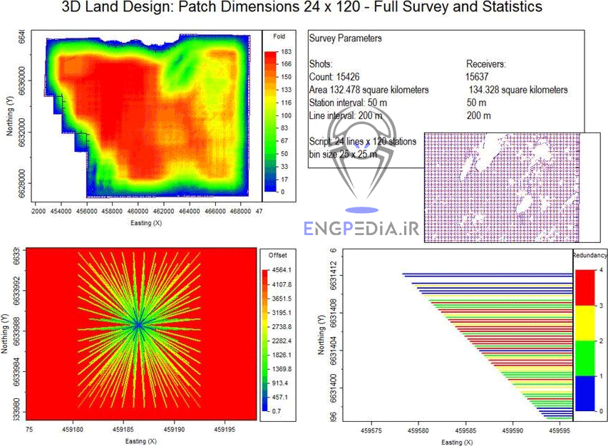
Create summary reports of design parameters and survey statistics
Generate 2D charts displaying statistical information about the design (rose diagrams, trace count, azimuth distribution, offset distribution, Kx-Ky plots, etc.)
Compare surveys and their analyses using map boxes in plot view
Overlay bin information on individual bins within the survey
Toggle between survey or status files within bin view
Compare statistical differences between designs
Visualize effect of your design with interactive modules
Create offset vector tiles (OVTs) and compare continuity between them to prevent artifacts from entering the data during processing
Compare all OVTs as planes within a status file
Multiproject handling
Create multiple surveys or versions of the same survey within the same project for easy comparison and QC
Full suite of editing tools
Edit one or more station positions easily using editing tools and wizards
Edit shot and receiver stations separately or concurrently
Undo your changes within the wizards
Create and update attributes
Color-code stations based on attributes
Import shapefiles into polyline and polygon wizards
Imagery and elevation data
Acquire aerial images and elevations with free download from Microsoft Bing Maps or from private web map service
Set station elevations from a variety of sources
Advanced analyses module
Assess 3D geometry effects on DMO, poststack time migration, multiples, and noise
Analyze potential 3D geometry artifacts (footprints) using existing 2D seismic traces
Estimate poststack time migration illumination using Fresnel zone binning
Generate synthetic SEG-Y data using survey geometry and a 3D model and zero amplitude of critically refracted rays
Build a depth cube of stack fold to analyze illumination at depth
Analyze illumination on a subsurface horizon using any survey geometry
Review reflection angle maps and statistics for every 3D illumination analysis
Estimate trace quality using 5D interpretation
Investigate AVO response with data statistics and QC displays
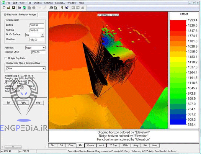
3D ray model module
Investigate parameters such as bin size, offset, resolution, and imaging (migration) effects
Build multilayer 3D models, including surface topography
Create horizons using theoretical parameters or imported horizons
Model diffractions, reflections, and exploding horizons
3D grid model module
Investigate parameters such as bin size, offsets, resolution, and imaging effects
Build velocity cube with the target reflecting horizon
Model diffractions, reflections, and shot-receiver ray paths
Execute eikonal finite-difference ray tracing
Elastic wave equation module
Calculate elastic or acoustic wave equation response using a finite-difference solution
Create full-waveform 2D synthetics using surface, VSP, OBC, and interwell geometries
Import model parameters from 2D ray models
Add user-defined velocity gradients and heterogeneity
Output real-time movies of shot wavefronts in Microsoft AVI format
Monitor calculations interactively
Work on multinode clusters
Spread work across your local network with the built-in cluster manager
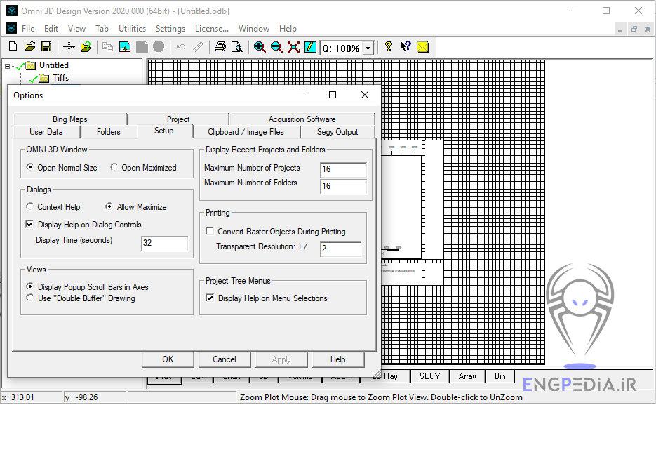
در ادامه عکس هایی از محیط نرم افزار OMNI 3D Workshop نشان خواهیم داد.






نسخه های زیر از نرم افزار OMNI 3D بصورت کامل توسط شرکت سازنده منتشر شده است.
v11 2011
v12 2012
v20 2021
مطالب مرتبط



برچسب ها : OMNI 3D Seismic Survey Design, OMNI 3D Workshop, خرید OMNI 3D Workshop, دانلود OMNI 3D Workshop, زلزله, طراحی نقشه برداری لرزهای, نرم افزار نقشه برداری
دیدگاهتان را بنویسید
نشانی ایمیل منتشر نخواهد شد

مطالب جدید
- Mirion Genie 4.1 تحلیل طیف سنجی آلفا و گاما
- Imaris 11.1 تحلیل و پردازش تصاویر میکروسکوپی
- MOSES Wind Turbine 2026 طراحی و تحلیل توربین بادی
- AVEVA Historian v20 تحلیل داده های فرایندی در صنعت
- SafeSite 3G v7.28 تحلیل نشت مواد شیمیایی، آتش سوزی و انفجار
- Synopsys PowerX 2025R2 تحلیل ادوات نیمه هادی قدرت
- PHA-Tool 1.0.37 تحلیل خطرات فرایندی و ارزیابی ریسک صنعتی
- Mastercam 2026.R2 طراحی و برنامه نویسی ماشین کاری CNC
- Ansys TETK 2026 طراحی، اجرا و ارزیابی آزمون های ماموریتی
- RayXpert 2026 مهندسی هستهای، دوزیمتری و حفاظت پرتویی

مطالب پربازدید
- پکیج کامل استانداردهای صنعتی
- دانلود کتاب هیدرولیک و پنوماتیک فستو Festo فارسی
- دانلود فول استاندارد ASTM بصورت رایگان
- کلید فولاد (Key to Steel) پرتابل
- آموزش میکروکنترلر AVR
- دانلود آنتی ویروس شورتکات (Back 2 Normal)
- دانلود جدول استاندارد DIN
- دانلود کتاب آموزش Abaqus (فارسی)
- فول استاندارد ASME (بروز)
- دانلود نرم افزار MATLAB برای آندروید(MATLAB Android)

مطالب تصادفی
- پروژه شبیه سازی معادلات Navier Stokes در متلب
- نرم افزار رسم منحنی بزیر (Bézier curve)
- Oasis Montaj 2026.1 تحلیل دادههای ژئوفیزیکی
- PROKON 5.3 نرم افزار طراحی و تحلیل سازه
- IHS Perform 2013 بهینه سازی بهره برداری از منابع نفت و گاز
- فول استانداردهای ASTM
- دانلود تحلیل مکانیزم میل لنگ با آباکوس
- Win DownHole 5.1 تفسیر داده لرزهای چاه نفت و گاز
- Device Modeling MQA 2026 اعتبارسنجی SPICE و QA
- CAESES 2026.1 طراحی پارامتریک و بهینهسازی تجهیزات صنعتی

شبکه های اجتماعی
دانشنامه تخصصی مهندسی ایران را در شبکه های اجتماعی دنبال کنید


